Whenuapai and Redhills wastewater project
Wastewater upgrades are required to cater for development.
Duration
Early 2024 - late 2027
Location
Whenuapai, Redhills and Hobsonville
Status
Construction
Project overview
The Whenuapai Redhills Wastewater Scheme is a key component of Watercare's wastewater investment programme supporting growth across Northwest Auckland.
The project will provide wastewater capacity to support existing communities and future urban development within Whenuapai, Red Hills, Hobsonville and surrounding growth areas.
Package 3 has now been completed. The project is now progressing into the delivery of a merged construction programme incorporating Packages 1 and 2.
The proposal
The merged Package 1 and 2 programme includes:
Package 1
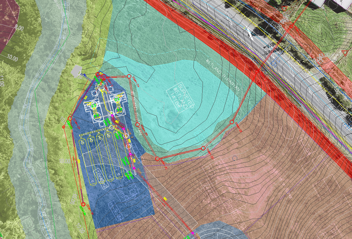
- Interim Pump Station (IPS)
- Associated wastewater rising mains
- Open trench and trenchless pipeline construction
- Chambers and network connections
- Utility relocations and protection works
- Decommissioning of the Whenuapai Village Pump Station
Package 2
- Break Pressure Tank (BPT) at Mamari Road
- Massey Connector Tunnel
- Northern Interceptor Tunnel Phase 2
- Shafts 8, 12, 14 and 17
- Hobsonville Pump Station connection
- Air Treatment Facility and odour control systems
- Mechanical, electrical and control infrastructure
The project includes approximately 3.8km of wastewater tunnels, associated shafts, pumping infrastructure and pipeline connections extending between Whenuapai, Red Hills and Hobsonville.
Timeline
Package 1: October 2027 - February 2030
Package 2: December 2026 - February 2030
Package 3: Completed
Project map

Current works
Package 3 Completion
Works associated with Package 3 have now been completed, including the construction of new wastewater pipelines and associated reinstatement activities.
Upcoming Works - Package 1 & 2
Preparations are underway for the commencement of the merged Package 1 and 2 construction programme, which will deliver major wastewater infrastructure across Whenuapai and Hobsonville.
Early activities will include site establishment, stakeholder engagement, detailed construction planning, utility coordination and enabling works ahead of main construction.
Residents, landowners, businesses and stakeholders will receive further information prior to works commencing in their area.
Consent documents
Consent documents
Consent decisions and approved plans
Package 1 Revised Regional Consent Lodgement and S92 Appendices- November 2023
S92 Attachment 1: Updated AEE – 9 November 2023
S92 Attachment 2: Borehole 117
S92 Attachment 3: Cut / Fill Plan for the Pump Station
S92 Attachment 4: Regionwide Wastewater Network Discharge Consent
Appendix B1 – Records of Title
Appendix C – Ecological Impact Assessment
Appendix D – Groundwater and Settlement Effects Report
Appendix E – Detailed Site Investigation
Appendix F – Erosion and Sediment Control Plan
Appendix G – Permitted Activity Assessment
Appendix H – Network Discharge Consent
Appendix I – Records of Engagement
Appendix J – Sinton Stream Culvert Compensation Plan
Appendix K – Wetland Monitoring and Reinstatement Plan
Appendix L – Arboricultural Assessment
Appendix M – Groundwater and Settlement Monitoring and Contingency Plan
Appendix N – Functional Needs Assessment
Appendix O – Pumpstation Dewatering Discharge Water Quality Assessment
Package 1 Revised NoR Lodgement - October 2023
Revised NoR Package 1 – AEE – 4 October 2023
Appendix B –Designation Boundary
Appendix D – Ecological Impact Assessment
Appendix E – Landscape and Visual Assessment
Appendix F – Geotechnical Interpretive Report
Appendix G – Detailed Site Investigation
Appendix H – Erosion and Sediment Control Plan
Appendix I – Assessment of Alternatives
Appendix L – District Matters and Permitted Activities
Appendix M – Arboricultural Assessment
Appendix N – Noise & Vibration Assessment
Appendix O – Traffic Impact Assessment
Appendix P – Records of Engagement
Appendix Q – Functional Needs Assessment
Package 2 Lodged Consent Application Documents
Package 2 AEE – 30 August 2023
Appendix B – Arboricultural Assessment
Appendix C – Ecological Impact Assessment
Appendix D1 – Groundwater and Settlement Effects Assessment
Appendix D2 – Groundwater and Settlement Effects Appendices
Appendix E – Ground Contamination Detailed Site Investigation
Appendix F – Erosion and Sediment Control Plan
Appendix G – Noise and Vibration Assessment
Appendix H – Groundwater and Settlement Monitoring and Contingency Plan
Appendix I – Contaminated Site Management Plan
Appendix J – Traffic Assessment
Appendix K – Records of Engagement
Package 1 Original Regional Consent and NoR Lodgement - October 2022
Appendix B - Designation Boundary
Appendix D - Ecological Impact Assessment
Appendix F - Groundwater Assessment
Appendix I - Proposed Designation Conditions
Appendix J - Assessment of Alternatives
Appendix K - Records of engagement
Appendix L - Arboricultural Assessment
Appendix M - Preliminary GSMCP
Appendix N - Noise and Vibration
Package 1 NoR S92 Request & Responses - November 2023 - March 2024
S92 Request for Information – 13 November 2023
Attachment 1 – Further Information Request – 13 November 2023
Appendix 1 to Attachment 1 – Transport Specialist Review – 9 November 2023
S92 Response – 19 January 2024
S92 Response Attachment 1 – Section 92 Response table
S92 Response Attachment 2 – Phasing Summaries
S92 Response Attachment 3 - Eastern Route 12d Sketch and Longsection
S92 Further information response – 8 March 2024
Package 1 Regional Consent S92 Request & Responses - January 2024 - February 2025
Package 1 Regional Consent S92 Request & Responses - January 2024 - February 2025